BY KAYLA FERMIN, BIOLOGICAL TECHNICIAN
Since the 1880s, over 70% of historical tidal wetlands in the Columbia
River estuary have been lost due to human impacts such as diking, land
conversion for agriculture, and urban development. Beginning in 2006,
the National Park Service has been actively restoring areas along the Lewis
and Clark River contributing to the recovery of the Youngs Bay watershed
and endangered salmon stocks. In the 44-acre site, Colewort Creek, a
bridge replaced a culvert and tide gate to ensure salmon could once again
return to the Lewis and Clark River floodplain. Excavated channels and
native plantings have improved and increased wildlife habitats. These and
other restoration projects throughout the Lower Columbia River are
enhancing the estuary so native runs of wild fish can thrive. With these
efforts, we are doing our part to recover the abundance and diversity
known for time immemorial by Indigenous people here and experienced
by the Corps of Discovery during its stay.
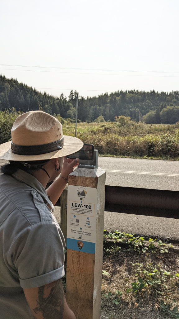
There are two Chronolog stations in the park; on the Lower Slough Trail
and the Netul Trail both facing towards the Colewort Creek Restoration Site.
Visitors place their cellphones upright in the bracket at the station, snap a
photo and then email the photo following the instructions on the sign. Once
submitted, they receive a reply with a time lapse of the site made up of other
visitor photos. By submitting photos at these Chronolog sites,
community scientists can assist park managers track landscape
changes over time.
Visit Chronolog.io to view the project and explore the
Chronolog stations, and to learn more about the tidal wetland restoration projects at
Lewis and Clark NHP, view this interactive story map